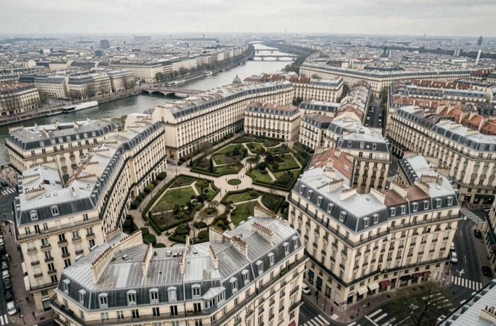
Aerial photography applied to Parisian real estate relies on a constraint that most online listings overlook: Paris intra-muros is classified as a permanently restricted airspace (LF-P23), closed 24/7 to any aircraft, including drones, except for exceptional exemptions. This regulatory reality, renewed by the order of April 2, 2025, conditions every aerial image published for a property located in the twenty arrondissements.
Zone LF-P23: the drone regulation that governs aerial views in Paris
The permanently restricted zone LF-P23 covers all of Paris intra-muros, excluding the Bois de Boulogne and Bois de Vincennes. Any drone capture in this area requires an exemption granted jointly by the police prefecture and the DGAC.
Sanctions for violations can reach up to one year of imprisonment, a fine of 75,000 euros, and the confiscation of equipment. This is one of the most restrictive contexts in France for aerial photography, which explains why legitimate drone images of Parisian properties remain rare compared to those from the inner suburbs.
Since January 1, 2026, paid professional flights over public space in urban areas are possible in the open category, but with mandatory prefectural declaration. This development does not lift the specific ban in Paris: it concerns neighboring municipalities and the rest of Île-de-France, where drone operators can now work with a more flexible administrative framework.
For a developer or an agency wishing to showcase a Parisian real estate program from an aerial perspective, there are two practical options: obtain the exemption (a lengthy, costly procedure reserved for large-scale projects) or use already authorized aerial image databases. An overview of the Paris vu d’avion site allows you to see how these overhead shots are utilized for Parisian properties without violating regulations.
New real estate programs in Paris: what aerial views reveal
In the new market, aerial views serve not only to produce beautiful images. They fulfill a precise technical function: to show the integration of a program into its urban environment even before delivery.
Orientation, the density of neighboring buildings, and the distance to green spaces become clear in seconds from a bird’s-eye view. This information, difficult to convey through a site plan or a traditional 3D perspective, directly influences the perception of brightness and tranquility of a future home.
Developers who incorporate aerial views into their communication find that buyers identify location advantages more quickly. A program located on the edge of the Canal Saint-Martin or facing a park becomes more readable when the photo shows the neighborhood from above rather than at street level.
Aerial 3D perspectives and construction monitoring
Aerial 3D modeling complements real photography. It allows simulating the view from the upper floors of a building under construction, at a time when no drone can yet fly over the finished site.
Drone site monitoring mainly concerns sites in the inner suburbs or large project areas like the Grand Paris Express. Regular images taken at defined intervals document the progress of work and serve both commercial communication and internal technical control.
Virtual tours and aerial videos: impact on real estate sales
The combination of an interior virtual tour and an exterior aerial video creates a complete discovery journey for the distant buyer. This format meets a concrete need: to filter physical visits in advance to only move interested buyers.
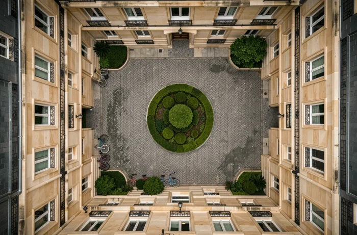
- The aerial video shows the roof, the inner courtyard, the parking, and access points, elements rarely photographed in traditional listings.
- 360-degree virtual tours, coupled with drone views, allow transitioning from macro (neighborhood, orientation) to micro (rooms, volumes) seamlessly.
- Oblique aerial photos, taken at 45 degrees, reveal the actual height of neighboring buildings and potential sightlines, a determining factor in Paris.
For prestigious properties, this comprehensive visual approach has become a communication standard. Agencies that do without it lose attractiveness compared to listings enriched with aerial content.
Real estate expertise and aerial surveying: beyond communication
Aerial views go beyond marketing. In real estate expertise and valuation, aerial surveying allows for identifying roof pathologies, undeclared extensions, or encroachments on neighboring parcels.
An aerial survey detects anomalies invisible from the street: roof sagging, invasive vegetation on party walls, condition of chimney stacks. These findings feed into expertise reports and can impact the valuation of a property.
For Parisian co-ownerships, where access to roofs is often complex, drone capture (when the exemption is obtained) or the use of high-resolution satellite images advantageously replaces costly physical inspections with lifts or scaffolding.
Limitations of aerial views for valuation
Bird’s-eye photography does not replace structural diagnostics. It provides visual clues, not precise measurements of waterproofing or resistance. An aerial shot complements the expertise, it does not replace it.
Images taken at too high altitudes lose resolution and no longer allow distinguishing the actual condition of materials. The choice of altitude and angle of view remains a technical parameter that conditions the usefulness of the final result, whether for selling or valuing a Parisian property.